Monday, August 30, 2010
Chochetopa Park
Day 25
Miles hiked today: 21.2
Miles from Denver: 324
Elevation: 9,720 ft
Segments 18, 19
Landmarks: Continental Divide Trail, Gunnison National Forest, Chochetopa Park, Chochetopa Creek
VIEW MAP
It was very hard to get out of Gunnison. I ended up spending two zeroes there. Yesterday I actually tried to leave, but I stood by the highway for over an hour and didn't get picked up. That kind of killed my motivation to hike that day, and I ended up wandering across the street into the Pioneer Museum, and ended up spending several hours there. I can highly recommend this museum, by the way.
So I found myself this morning, motivated to put some miles down, and anxious to get going, getting soaked by a rain storm on an errand I was running. This was not a good way to start the day. I ended up stalling a little longer indoors until the rain stopped, and finally I was out the door by 11. Not exactly an early start, but at least I was dry.
I had to travel over 40 miles to get back to the trail, which is first 8 miles east on Rt 50, a very busy highway, and then 33 miles south on Hwy 114, which almost nobody travels. This could be a very long wait. Within a half hour I caught my first ride, a nice guy named Brian who was literally on his way to the airport to fly to Patagonia for a 1 year NOLS training course, which is National Outdoor Leadership School. When he comes out of that course he should be able to eat thru hikers for lunch.
The second ride I caught was from a guy named Jesus, who is a carpenter. No kidding. He pronounces his name (Hey-Soos), and he was just talking about his work on the way up, so I wasn't really thinking about it at the time. It wasn't until I got on trail that it dawned on me that I had just gotten a ride from Jesus the carpenter. The nice thing was that before I got in the car, he discussed that he was going 35 miles on Hwy 114, which worked for me because I was only going 33. However, when he dropped me off at the pass, he drove off the way we had just came, so I think we passed his work site and he didn't say a word.
I finally got on trail at 12:30 pm, which is not exactly early. I am trying to make it to Silverton in 5 days, which is 106 miles away. This means that I planned to go at least 20 miles each day, and I was a little worried now. I have a 3 mile an hour pace when I really hurry, and once, on the AT I had gone 21 miles in exactly 7 hours. I never thought I would try it again on this hike, but there is no time like the present. The terrain is flat, and is supposed to be easy walking. 21 miles also happens to be how far it is to the next reliable water source. I started out at a brisk pace.
Not a half mile from the road, I came upon some trail magic. A guy named Burnfoot had stocked two coolers with soda, and there was a register there as well to sign in. The register was full of fun anecdotes, and high praise for burnfoot leaving these sodas here. Had I not been in town for nearly three and a half days the soda probably would have tasted much better to me, but I am extremely thankful all the same, and especially on this trail which is barren on trail magic, this is very welcome. Packing a root beer with me, I was also able to go the entire day without needing water.
The guidebook talks about this being one of the most scenic segments of the whole trail, but at first I just wasn't getting it. I was on roads of some sort or another the entire day. There are forest service roads, fire roads, county roads, jeep tracks and hunting roads. Not a bit of trail, and all of it accessible to horses, mountain bikes, motorcyles, ATVs and any other kind of vehicle you want to bring. This is a far cry from the footpath-only regulations I know and love, but this is offset by the fact that I didn't see a soul of any means of transport, all day.
About halfway through the afternoon I came upon the scenic part. I have learned that in Colorado, a park is what you call a vast, open space in the mountains. Chochetopa Park is such a place, and it is very impressive. It goes for as far as I could see, and is dotted with small stands of trees, with a plateau on one side, and tree covered hills on the left. At the far horizon there are some mountains, but these are so far away that they looked very tiny. This is ranch country, and a barbed wire fence cuts through the scene, until I couldn't see it any more. It is kind of like walking through a smaller version of Shirley Basin.
The trail takes about six miles to get across this, and it is a very scenic, and windy walk. I had beautiful weather, but I would not want to walk across this when it was cold, windy, raining or snowing. Eventually I got to a road, where the trail turned left on the road, up into the hills. There was still much more to Chochetopa Park.
It was getting late in the day now, and I could see that I had nearly enough time to make the 21 miles, but I
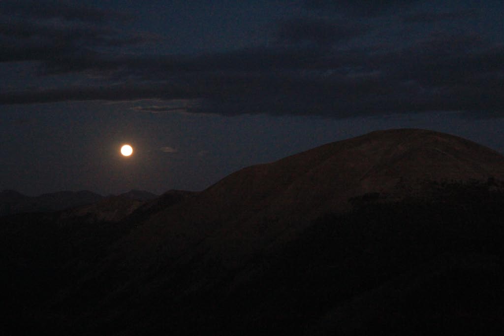
would be finishing up in the dark. Sunset came, and I was able to use the light from the sky to hike until nearly an hour past sunset. In the last couple of miles, the trail climbs 600 feet on a jeep road, then turns downhill to meet up with Chochetopa Creek. It was now nearly completely dark, but there was just enough light to shine off of the rocks, of which there were many. I was hurrying, as I wanted to get to camp and set up before any weather could set in, as there were a few dark clouds overhead. My feet moved swiftly, uncannily finding all the spots where there were no rocks, never kicking or tripping on one. I have experienced this phenomenon once before, but I have never been as sure footed when hiking as I was just now, despite barely being able to make out the contours of the trail, much less where all the rocks are. It is a really strange sensation. I flew down the hill, and finally in the last mile I was forced to stop and dig for my headlamp, as mists of rain started falling.
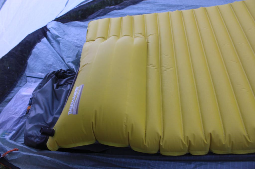
Luckily, the weather moved on as I found a campsite next to a gurgling creek and set up my tent. It's the worst job of setting up my tent I've done yet, and the thing sagged in crucial places. I would be very grateful if it doesn't rain on me tonight.
Friday, August 27, 2010
Gunnison
Day 22
Miles hiked today: 13.1
Miles from Denver: 302.8
Elevation: 9,680 ft
Segment 17
Landmarks: Continental Divide, Continental Divide Trail, Razor Creek, Lujan Creek, Gunnison National Forest, Rio Grande National Forest, Gunnison
VIEW MAP
Last night I contemplated making an escape off trail into Gunnison or back to Salida, on Rt. 50. I should have taken a zero in Salida, and my body is suffering for it. I have 40 miles to go to Creede, and not sure I can make it.
This morning I put all thoughts out of my head, as I was feeling better and figured the night's rest had fixed me up. I packed up and, stupidly, didn't fill my water bottles at the lake because the guidebook says there is water 3.5 miles ahead, at Razor Creek. I had about a 300 foot climb to get back to the trail, and didn't want to carry the weight. I planned on stopping for breakfast at the creek, but there wouldn't be another water source for another 9 miles after that.
Soon I encountered Thumbs Up, who had camped a little behind the turn for the lake and got going a little earlier than I did. I told him I would see him at breakfast, and pushed on.
Soon I passed a sign for the Razor Creek trail, and then a dry creek bed. Uh-oh. According to the map, this was Razor Creek, and it was dry. Thumbs Up arrived, and we put our two different maps together and determined that we were in the right spot, and there was no running creek. About a quarter mile back, uphill, there was a small little puddle where the creek crossed the trail. That was the only water for miles.
One of my all-time favorite pieces of gear has to be my Platypus water tank, which is a plastic water bag that holds 4 liters and has handles. I use it every time I filter water, putting the water first in the bag, then filtering out of the bag. This allows me to avoid putting my filter intake down in the mud, and also allows me to move the water to a comfortable sitting place so that I can pump the filter. This came in very handy just now, and before long I had two water bottles full of clear but slightly strange tasting water. It would have to do.
I told Thumbs Up about my thoughts about taking a break from the trail, and he had an overview map of Colorado and pointed out that the upcoming highway could take me to Rt. 50, and then to Gunnison. I was still feeling like I could make the next 40 miles into Creede, and told him it was just something I was thinking about.
The trail sticks pretty close to the Divide right here, which means that there is a lot of climbing and descending. Pretty soon it descended to a place called Lujan Pass, which looks like it was settled at one point, and has several spots that bear the evidence of long-ago standing buildings. The trail joins a forest road from there, and descends off the divide and down to the highway. It is also near the 300 mile mark.
As the road went down, it followed Lujan Creek which was not much more than a trickle in spots, an underground creek in others. There was thick brush or rocks in many spots preventing access, but finally I found a spot that had a nice resting spot and had access to a small flow of water. This would be the last water source for the next 20 miles of trail, potentially. I stopped and cooked my dinner as my lunch so that I wouldn't need water to cook later, and filled up my extra water bag for the long haul.
When I got going again, just a mile from the highway, I changed my mind. I was going to be suffering a lot over the next several days if I didn't take a rest, like I should have. Gunnison was about 40 miles away, but just a thumb on my part. I left Thumbs Up a note explaining my absence, and hitched into town. A very nice guy named George stopped, who commutes once a week on this road, every Friday, from San Louis to Montrose, which takes him through Gunnison. I was very fortunate he stopped, because this should be a near impossible hitch, on a road that isn't supposed to have any traffic. He said he had once picked up a thru hiker, which is why he stopped for me. He had a cooler with soda and peaches, and bid me to help myself. Hwy 114 travels for 33 miles through an unbelievable rocky red canyon, and George said there are over 500 Big Horn Sheep that live in it. Sure enough, we spotted some and we got out of the pickup to get a better look, and he had a pair of binoculars. Overall it was a nice bit of trail magic, to find such a ride in such a place, with someone who only comes that way once a week. Thanks George!
So I'm all set for a day off, and I will pick up where I left off on Sunday. Now I should be able to get all the way to Silverton without stopping in Creede or Lake City, a distance of 108 miles. I've hiked such a distance once before, in Maine's 100 Mile Wilderness, which has a great and famous sign at the start, warning hikers not to enter unless they are carrying at least 10 days of supplies. This is always a humorous photo stop for a thru hiker. I'll carry 5 days worth.
Thursday, August 26, 2010
Sargents Mesa
Day 21
Miles hiked today: 18.1
Miles from Denver: 289.7
Elevation: 11,480 ft
Segments 16, 17
Landmarks: Continental Divide, Continental Divide Trail, Tank Seven Creek, Cameron Park, Sargents Mesa, Baldy Lake, Gunnison National Forest, Rio Grande National Forest
VIEW MAP
I woke up early to a magnificent sunrise, the colors of which were already lighting up my tent in purple and pink hues. I got out of my tent, took in the sight, then went back to bed. It was still early. In what seemed like minutes later in the dream world, I awoke again with direct sunlight shining on my tent.
I had stopped just short of the water source last night, so I intended to walk about a quarter mile or however far it was and then stop and cook breakfast. Thumbs Up, who had camped somewhere behind me, came up just as I was rolling out. The two of us came upon Paul just as he was rolling out, a quarter of a mile later. It was like Thumbs Up was conducting the rolling wakeup call. They went on as I stopped for water and breakfast. Just as I was packing up, Gil came along, who is a thru-hiker of the Continental Divide Trail from Israel. He's done the Pacific Crest Trail as well, so is close to completing his second of the three big trails.
A couple of miles later, all three of them were stopped for a snack break, and I joined in, making four. This is more thru-hikers gathered in one place than I had seen this entire trail, and nearly as many as I have seen combined. Truly a rare moment on this hike. I would not see Gill again, as he is a very fast hiker, and is pushing big miles to get done.
The big water source today was Tank Seven Creek. Thumbs Up thinks Tank Seven is a reference to a water tank for a railroad's steam engines somewhere farther down. This was only seven and a half miles into the day, and already it was past noon. The miles today were not going very fast. Paul and Thumbs Up were at the water source, and soon Paul left and I stayed for a bit to grab some lunch. I hiked on just after one, leaving Thumbs Up stretched out on his mattress eating his meal. I turned right at the T junction, and started downhill. I had heard Paul mention something about how we follow Tank Seven Creek for about a half mile, but I was surprised that I was going downhill, and kept waiting for the turn away from the creek. After almost a mile I could see the trail was emptying into a valley ahead, and got a bad feeling about it. It is not unusual on this trail to not see trail markers- the Colorado Trail logo on plastic placards nailed to trees- for long stretches. But I had not seen a single marker since leaving the lunch spot, and I was losing elevation fast in a segment that was supposed to be following the Continental Divide. I got out my map, and sure enough I was following a side trail off the ridge to the north.
By the time I hiked uphill all the way to the spot where I had erred, I had wasted about an hour and a quarter, and Thumbs Up was gone. I had not looked at the sign at the T-junction. Finding the right way, I started uphill through Cameron Park, which is a meadow and used to pasture cows. These cows were not as quick to move out of my way as cows usually are, and showed a little more attitude.
Soon I found Thumbs Up stopped at a very murky mud puddle, fouled with cow poop. There was so little water in this segment that it was worth contemplating filtering the water, but ultimately both of us passed on it. He was surprised that I had gotten behind him, and I related my misadventure down the Tank Seven Creek trail.
It was almost 10 miles from Tank Seven Creek to the next water source, which was a lake called Baldy Lake, which was a half mile off trail and a 320 foot loss in elevation. Making this water source would be an 18 mile day, or I could go for Razor Creek which was another 3.5 miles. The miles were going so slow today that I decided to make for Baldy Lake.
Sargents Mesa is a very interesting place. Right now the trail is in a relatively low area, traversing between the big mountain ranges of the Sawatch Range to the north and the San Juans to the west. Sargents Mesa is a high plateau that is slightly slanted back to the east, a giant flat meadow at 11,600 feet that provides unlimited views in three directions; north, east and south. The mesa is used as pasture land, so there are a lot of cows up here enjoying the view as well.
The rest of the day went very slowly. I passed a sign that said 4.5 miles until Baldy Lake, and those 4.5 miles ended up feeling like six. I was tired and ready to stop, but the lake was the only water source. Finally I looked at the map and learned that the trail made a turn due west right before it got to the lake, which helped me stop hoping to see the sign for the side trail around every corner.
Finally the sign came, and the descent down to the lake. I was the only one there, and had this beautiful alpine lake all to myself, walled in on the far side by a steep mountain of rubble, and a well situated campsite with nice flat ground on the other. A few chipmunks officiated while I ate dinner, but other than that I didn't see or hear any wildlife.
When I laid down on my sleeping mat, I heard a loud tearing sound. This is Thermarest's Neoair, the latest and greatest new thing, but it has over the last week or so transformed from a flat sleeping pad to a giant round air filled pillow. The inner baffles near the head end are seperating on the inside, and each night it gets a little worse. The tearing I heard doubled the effected area, and I'm hoping this thing holds out to the end, or until I can get REI to replace it for me.
Wednesday, August 25, 2010
Marshall Pass
Day 20
Miles hiked today: 18.3
Miles from Denver: 271.6
Elevation: 11,240 ft
Segments 15, 16
Landmarks: Salida, Fooses Creek, Continental Divide, Continental Divide Trail, Marshall Pass, Mt. Ouray
VIEW MAP
I started out this morning with two other hikers, Paul from DC and Thumbs Up from Colorado Springs. We got a slow start out of town because we made a stop at the First Street Diner and smashed a lot of food. There was a girl named Jamie staying at the hostel who we bribed to drive us up to the trailhead, so she kindly re-arranged and emptied her entire car to fit three cleaned but still slightly smelly hikers, and drove us the 20 or so minutes one way up to the trail.
Segment 15 starts out on a road and ends on a road, but whats in between is really spectacular. We started out by following Fooses Creek from Rt 50 up to the Continental Divide. That was a very long, 8 mile climb. At the top, there is a panoramic view in all directions of dramatic peaks, many of them 14ers. The Continental Divide Trail re-joins with the Colorado Trail here, and will continue with it for over the next 100 miles. We will follow the Divide for quite some time now.
The weather could not have been better. Fat, puffy lazy clouds marched steadily by, as for mile after mile the trail stayed above tree line, affording a different picture each time I looked up. The weather never threatened or wavered, and it was very warm, even by the time I made camp.
Because the trail now follows the Continental Divide for a while, water is very scarce and it has become important to pay close attention to when the next water source is. The length of my hike today was dictated by that, and I was making for a place called Silver Creek which has water a third of a mile off trail. Paul was headed there too, and Thumbs Up was smart and already ate, so he planned to camp wherever there was a good view.
Marshall Pass is a pretty interesting place. It is a route across the mountains that was used by one of the railroads to get to Gunnison, and even though this route was longer, it got there faster because the grades were easier. The guidebook has a story about a Lieutenant William Marshall, who discovered this shortcut because he had a toothache and had to get to Denver in a hurry. As for the trail, a few miles before the pass it is routed onto an old mining road, which today allows use of ATVs and motorcycles. I would find that most of this next segment is like that too, and the quality of the trail drops considerably.
![]() |
| The only shelter on the entire Colorado Trail |
I stopped about a quarter mile before the water source, knowing I had enough to get through the night, and because I found a campsite on a ridge with a really incredible view to the east. There was a panorama of peaks lit with orange light as I made my dinner and set up camp, and the weather was still as calm as ever. What a great day.
Tuesday, August 24, 2010
Salida
Day 19
Miles hiked today: 10.4
Miles from Denver: 253.3
Elevation: 8,840 ft
Segment 14
Landmarks: San Isabel National Forest, Mt. Shavano, Angel of Shavano, Salida
VIEW MAP
It rained all night, and my tent was on an incline, slanting from left to right. This meant that to prevent sliding completely into the opposite wall of the tent, I was sleeping on the edge of my sleeping pad, balanced precariously in that spot where I wouldn't roll into the wet tent wall. As always when there is any moisture on my tent however, the foot of my sleeping bag soaked it up because I've found it inevitable that my feet touch the wall.
So I got up, packed up a wet sleeping bag and a wet tent, and joined The Professor and Crash for some breakfast. Once again they had boiled a lot of water, so there was a pot ready for my oatmeal and coffee. These guys pack heavy, and have large cook pots and large stoves and large food canisters. They were headed in the opposite direction and planned to stay at Mt. Princeton Hot Springs Resort, so I'm sure they didn't mind burning a little extra fuel.
Bidding them goodbye and thanks, I started south once I had everything ready. It was a grey, foggy, moist day. My camera stayed in the backpack except for the one time I brought it out to get a picture of the fogged in trees. The forest is really beautiful at a time like this, especially through the aspen groves. At one point I stopped when I saw the specter of a cow opposing me, which turned out to be nothing more than a real cow, in thick fog. Now that would have been a great picture.
It wasn't long before I came upon the Mt. Shavano side trail. This is another 14er, but not one I had planned on climbing, even with good weather. It is a 10 mile round trip. The nearby trailhead is called Angel of Shavano, because when there is snow on the mountain, but not too much snow, it makes the shape of an angel. This, like the Mount of the Holy Cross, has drawn many visitors through the decades.
It was not a far walk today, as I was going about 10 miles to US 50 to go into town. The fog never lifted, and it was rather chilly. There seemed to be one giant cloud just parked right on the mountain, which wasn't going anywhere. When I got off the mountain I could see that this was very much the case.
I got rides from two different people; one a New Zealander named Mark who thought he was going through Salida, but actually was turning before it. So he left me at a gas station about half way, where I caught a ride with a guy named Oscar who was driving to Texas. Oscar wasn't sure either if he was going through Salida, but he decided to try it anyways and dropped me in town. I'm sure he would have hit Texas had he gone through Salida or not, so he should be in good shape.
Salida is my favorite trail town so far. It has a very vibrant historic downtown, with a disproportionate number of art galleries. There are plenty of ma and pop shops, including a shoe cobbler and a leather tanner. I didn't see a single empty storefront, and business looks like it is good. The Arkansas River runs right past downtown, which is a huge river for kayakers and white water rafting. There are a few restaurants right on the water where you can watch the kayakers run the rapids. Above the town are some mountains, one of them with a giant 'S' on it, and a peculiar white house perched above the S, with what appears to be a spiral trail going up the mountain. At night I discovered that they light the S, alternately with a giant heart, because Salida claims to be the heart of the rockies.
I'm staying at a great hostel called the Simple Lodge, and am headed out tomorrow on the longest, most remote portion of the trail. It's 90 miles before my next resupply stop, so I have packed my food bag as full as its been yet. I am excited because this is reputably the most beautiful portion of the trail coming up, with the trail spending most of the time above tree line and above 11,000 feet. This is what I've been waiting for!
Monday, August 23, 2010
Halfway
Day 18
Miles hiked today: 16.9
Miles from Denver: 242.9
Elevation: 9,600 ft
Segments 13, 14
Landmarks: San Isabel National Forest, Mt. Princeton Hot Springs, Raspberry Gulch, Browns Creek, Sand Creek
VIEW MAP
The place I had camped last night was only a mile or so away from the biggest roadwalk on the trail so far. They have been unable to connect the trail through National Forest land or otherwise in this spot, so the result is a 5.5 mile road walk. One benefit of that road walk is that the "trail" goes right by Mt. Princeton Hot Springs.
The hot springs are naturally occurring in the river, and supposedly this was discovered by whites in the 1860s and developed into a resort, even though the Indians had known about it for generations. Today, it is much like going to a public swimming pool, except the pool temperature is in the 90's, or you can go down to the river. There they have created little sitting areas along the side of the river, where the hot water comes out and can be up to 120 degrees fahrenheit, but mixes with the river water so it is just right. This is quite a thing to have along a trail, and I wasn't about to pass it by.
Admission was just 10 bucks, and kept me occupied for more than an hour. There were hardly any people there, even though I have been told that you had to wait quite a while for one of the spots along the river. They even allowed me to put my pack behind the main desk where they could keep an eye on it. After soaking for a time, I went next door to the Mt. Princeton Resort and Restaurant, where I was seated at an outdoor table on a beautiful day. I was told that today's special was the BLT with avocado and chipotle sauce plus fries for 7 bucks. This was quite within reason, so in no time I was enjoying that as well. This place really isn't half bad.
I got back on the trail, I mean road around 1 pm, and intended to make some miles yet today. First I had to navigate a couple more miles worth of roads, which for whatever reason aren't marked very well for CT users. Eventually the trail got off the busy highway and onto a very ancient road along the Chalk River, which had dozens of nice properties and bed and breakfasts. I learned a little later at the trailhead that this community is called St. Elmo, and is an old mining town. The nice houses there would have been miner's shacks at one point or the other.
About this time the clouds got really ugly, and a pretty good thunderstorm opened up. I was thankful to be down low along the river, because the thunder was directly overhead. It was a fast moving storm, and pretty soon I was shielding my eyes from the blinding sun and blue sky yet still getting pelted with rain. Soon the storm moved on entirely, but it wouldn't be the last of the day.
Soon after the road brought me to actual trail again, and I was able to once again walk without being passed by cars. The trail climbed about 800 feet to Raspberry Gulch, from the top of which I could see quite a ways south to where I was going. This next 20 miles of trail is low country, where the trail makes away from the Sawatch Range and down towards Salida, after which I will again climb the Continental Divide. Salida is also the halfway point, but technically I would pass the true halfway point today.
I aimed for a campsite listed in the data book, and as the evening drew late I arrived to find two thru hikers already there. They were nice guys, and bade me to set up my tent and even cooked hot water for my dinner. I learned within a few minutes that one of these guys, Steve, is the Chairman of the Colorado Trail Foundation. It was very interesting talking to him about the hard work that goes into this trail, the volunteer hours and the politics that surround trying to draw a continuous line through the state of Colorado. They were hiking in the opposite direction so that they could meet more thru- hikers, as something like 95 percent of us start in Denver and walk west. He said I was number 99 or 100 that they have run into.
I am halfway through now, and hope to finish the rest of the trail in right around 2 weeks. Tomorrow I will reach Salida, the last town before the really high country, and the resupply before a really big section of 90 miles between towns. So far I have been at 9 or 10 thousand feet with a few visits above 11 thousand. For the rest of the trail I will stay above 11, and even visit 13 thousand feet.
Sunday, August 22, 2010
Buena Vista
Day 17
Miles hiked today: 9.3
Miles from Denver: 226
Elevation: 9,600 ft
Segment 13
Landmarks: San Isabel National Forest, Buena Vista, Middle Cottonwood Creek, South Cottonwood Creek, Dry Creek
VIEW MAP
I didn't sleep well in the hotel bed last night. Actually there were 3 beds, as I got the only vacant room in all of Buena Vista, due to a cancellation, and it was a "suite." (This saved me from stealth camping in the city park). I realized once I woke up in the morning that part of the problem was there was just no circulation or ventilation whatsoever. The other problem was that I'm now used to sleeping in my tent.
This being Sunday, I had plans to make it to a church while I'm in town. I was hoping to do that up in Breckenridge as well, but it just didn't work out. So I found Cornerstone Church on google, and figured out the service was at 10:30. This gave me plenty of time to walk next door and get some breakfast, then walk to the north end of town to the outfitter, and finally back south to where the church was.
I devoured a monster breakfast burrito smothered in chili and sour cream, as well as a side of biscuits and gravy from Ponchos, the same place I ate last night. It barely phased me. I was very glad that the outfitter was open at 9, as I had sent a package there. This is the best outfitter I've seen yet on the trail, and I bought one particular item that I have been in great need of. Finally, I made my way back in to town.
This church was really incredible, and several people there took me in like family. I went to services a couple of times when I was on the AT, and you certainly draw a lot of attention to yourself when you have a backpack strapped on and two pointy poles sticking above your head. Thankfully, I had showered and done laundry last night so the congregation was spared the true thru-hiker experience.
I ended up sitting by a couple named Gary and Lucy, who turned out to be real good people. They invited me to lunch after the service, and pretty soon I was at the Red Rooster seated with 4 generations of this one family, from 5 years old up to 90. We had a great time, and I felt like I had been adopted for the afternoon. Finally it was time for everyone to go, and Gary was nice enough to drive me the 10 miles out to the trail, even though they had to get to Denver. Thank you Gary and Lucy, and to all the rest of the people I met today for your hospitality. What a wonderful stop this was in Buena Vista. (Before I forget, it seems that Buena Vista, CO has the same controversy as Buena Vista, VA. It seems that if you're a local, you pronounce it Boo-ena Vista. If you learned any Spanish, its Buena Vista.)
Very soon I was on trail, with 37 miles to get to Salida. I've decided that I'm not going to do this section as fast as I possibly can, which is one reason why I spent a half day in Buena Vista. There is a place called Mt. Princeton Hot Springs that I will encounter tomorrow, which I hear has pools and hot tubs and even hot springs in the middle of the river. Seems like a must stop to me. For tonight, it was a very pleasant couple hours of hiking. I am still wrapping around all the foothills, overlooking the vast valley on my left of the Arkansas River below. US 285 has taken the place of US 24 down there, and if I wanted I could take 285 north all the way to Jefferson, where I was on day 5 or so of this hike.
I found a beautiful campsite near the roaring, and badly named Dry Creek. I'm excited because I discovered another subtlety of this tent, which allows me to pitch it more taught. I may need that, because it is threatening rain for tonight, and possibly tomorrow as well.
Subscribe to:
Comments (Atom)


