Wednesday, August 25, 2010

Marshall Pass


Day 20

Miles hiked today: 18.3
Miles from Denver: 271.6
Elevation: 11,240 ft
Segments 15, 16
Landmarks: Salida, Fooses Creek, Continental Divide, Continental Divide Trail, Marshall Pass, Mt. Ouray

VIEW MAP

I started out this morning with two other hikers, Paul from DC and Thumbs Up from Colorado Springs. We got a slow start out of town because we made a stop at the First Street Diner and smashed a lot of food. There was a girl named Jamie staying at the hostel who we bribed to drive us up to the trailhead, so she kindly re-arranged and emptied her entire car to fit three cleaned but still slightly smelly hikers, and drove us the 20 or so minutes one way up to the trail.


Segment 15 starts out on a road and ends on a road, but whats in between is really spectacular. We started out by following Fooses Creek from Rt 50 up to the Continental Divide. That was a very long, 8 mile climb. At the top, there is a panoramic view in all directions of dramatic peaks, many of them 14ers. The Continental Divide Trail re-joins with the Colorado Trail here, and will continue with it for over the next 100 miles. We will follow the Divide for quite some time now.


The weather could not have been better. Fat, puffy lazy clouds marched steadily by, as for mile after mile the trail stayed above tree line, affording a different picture each time I looked up. The weather never threatened or wavered, and it was very warm, even by the time I made camp.


Because the trail now follows the Continental Divide for a while, water is very scarce and it has become important to pay close attention to when the next water source is. The length of my hike today was dictated by that, and I was making for a place called Silver Creek which has water a third of a mile off trail. Paul was headed there too, and Thumbs Up was smart and already ate, so he planned to camp wherever there was a good view.


Marshall Pass is a pretty interesting place. It is a route across the mountains that was used by one of the railroads to get to Gunnison, and even though this route was longer, it got there faster because the grades were easier. The guidebook has a story about a Lieutenant William Marshall, who discovered this shortcut because he had a toothache and had to get to Denver in a hurry. As for the trail, a few miles before the pass it is routed onto an old mining road, which today allows use of ATVs and motorcycles. I would find that most of this next segment is like that too, and the quality of the trail drops considerably.

The only shelter on the entire Colorado Trail


I stopped about a quarter mile before the water source, knowing I had enough to get through the night, and because I found a campsite on a ridge with a really incredible view to the east. There was a panorama of peaks lit with orange light as I made my dinner and set up camp, and the weather was still as calm as ever. What a great day.


Tuesday, August 24, 2010

Salida


Day 19

Miles hiked today: 10.4
Miles from Denver: 253.3
Elevation: 8,840 ft
Segment 14
Landmarks: San Isabel National Forest, Mt. Shavano, Angel of Shavano, Salida

VIEW MAP

It rained all night, and my tent was on an incline, slanting from left to right. This meant that to prevent sliding completely into the opposite wall of the tent, I was sleeping on the edge of my sleeping pad, balanced precariously in that spot where I wouldn't roll into the wet tent wall. As always when there is any moisture on my tent however, the foot of my sleeping bag soaked it up because I've found it inevitable that my feet touch the wall.

So I got up, packed up a wet sleeping bag and a wet tent, and joined The Professor and Crash for some breakfast. Once again they had boiled a lot of water, so there was a pot ready for my oatmeal and coffee. These guys pack heavy, and have large cook pots and large stoves and large food canisters. They were headed in the opposite direction and planned to stay at Mt. Princeton Hot Springs Resort, so I'm sure they didn't mind burning a little extra fuel.

Bidding them goodbye and thanks, I started south once I had everything ready. It was a grey, foggy, moist day. My camera stayed in the backpack except for the one time I brought it out to get a picture of the fogged in trees. The forest is really beautiful at a time like this, especially through the aspen groves. At one point I stopped when I saw the specter of a cow opposing me, which turned out to be nothing more than a real cow, in thick fog. Now that would have been a great picture.


It wasn't long before I came upon the Mt. Shavano side trail. This is another 14er, but not one I had planned on climbing, even with good weather. It is a 10 mile round trip. The nearby trailhead is called Angel of Shavano, because when there is snow on the mountain, but not too much snow, it makes the shape of an angel. This, like the Mount of the Holy Cross, has drawn many visitors through the decades.

It was not a far walk today, as I was going about 10 miles to US 50 to go into town. The fog never lifted, and it was rather chilly. There seemed to be one giant cloud just parked right on the mountain, which wasn't going anywhere. When I got off the mountain I could see that this was very much the case.

I got rides from two different people; one a New Zealander named Mark who thought he was going through Salida, but actually was turning before it. So he left me at a gas station about half way, where I caught a ride with a guy named Oscar who was driving to Texas. Oscar wasn't sure either if he was going through Salida, but he decided to try it anyways and dropped me in town. I'm sure he would have hit Texas had he gone through Salida or not, so he should be in good shape.

Salida is my favorite trail town so far. It has a very vibrant historic downtown, with a disproportionate number of art galleries. There are plenty of ma and pop shops, including a shoe cobbler and a leather tanner. I didn't see a single empty storefront, and business looks like it is good. The Arkansas River runs right past downtown, which is a huge river for kayakers and white water rafting. There are a few restaurants right on the water where you can watch the kayakers run the rapids. Above the town are some mountains, one of them with a giant 'S' on it, and a peculiar white house perched above the S, with what appears to be a spiral trail going up the mountain. At night I discovered that they light the S, alternately with a giant heart, because Salida claims to be the heart of the rockies.


I'm staying at a great hostel called the Simple Lodge, and am headed out tomorrow on the longest, most remote portion of the trail. It's 90 miles before my next resupply stop, so I have packed my food bag as full as its been yet. I am excited because this is reputably the most beautiful portion of the trail coming up, with the trail spending most of the time above tree line and above 11,000 feet. This is what I've been waiting for!

Monday, August 23, 2010

Halfway


Day 18

Miles hiked today: 16.9
Miles from Denver: 242.9
Elevation: 9,600 ft
Segments 13, 14
Landmarks: San Isabel National Forest, Mt. Princeton Hot Springs, Raspberry Gulch, Browns Creek, Sand Creek

VIEW MAP

The place I had camped last night was only a mile or so away from the biggest roadwalk on the trail so far. They have been unable to connect the trail through National Forest land or otherwise in this spot, so the result is a 5.5 mile road walk. One benefit of that road walk is that the "trail" goes right by Mt. Princeton Hot Springs.


The hot springs are naturally occurring in the river, and supposedly this was discovered by whites in the 1860s and developed into a resort, even though the Indians had known about it for generations. Today, it is much like going to a public swimming pool, except the pool temperature is in the 90's, or you can go down to the river.  There they have created little sitting areas along the side of the river, where the hot water comes out and can be up to 120 degrees fahrenheit, but mixes with the river water so it is just right. This is quite a thing to have along a trail, and I wasn't about to pass it by.

Admission was just 10 bucks, and kept me occupied for more than an hour. There were hardly any people there, even though I have been told that you had to wait quite a while for one of the spots along the river. They even allowed me to put my pack behind the main desk where they could keep an eye on it. After soaking for a time, I went next door to the Mt. Princeton Resort and Restaurant, where I was seated at an outdoor table on a beautiful day. I was told that today's special was the BLT with avocado and chipotle sauce plus fries for 7 bucks. This was quite within reason, so in no time I was enjoying that as well. This place really isn't half bad.

I got back on the trail, I mean road around 1 pm, and intended to make some miles yet today. First I had to navigate a couple more miles worth of roads, which for whatever reason aren't marked very well for CT users. Eventually the trail got off the busy highway and onto a very ancient road along the Chalk River, which had dozens of nice properties and bed and breakfasts. I learned a little later at the trailhead that this community is called St. Elmo, and is an old mining town. The nice houses there would have been miner's shacks at one point or the other.

About this time the clouds got really ugly, and a pretty good thunderstorm opened up. I was thankful to be down low along the river, because the thunder was directly overhead. It was a fast moving storm, and pretty soon I was shielding my eyes from the blinding sun and blue sky yet still getting pelted with rain. Soon the storm moved on entirely, but it wouldn't be the last of the day.


Soon after the road brought me to actual trail again, and I was able to once again walk without being passed by cars. The trail climbed about 800 feet to Raspberry Gulch, from the top of which I could see quite a ways south to where I was going. This next 20 miles of trail is low country, where the trail makes away from the Sawatch Range and down towards Salida, after which I will again climb the Continental Divide. Salida is also the halfway point, but technically I would pass the true halfway point today.


I aimed for a campsite listed in the data book, and as the evening drew late I arrived to find two thru hikers already there. They were nice guys, and bade me to set up my tent and even cooked hot water for my dinner. I learned within a few minutes that one of these guys, Steve, is the Chairman of the Colorado Trail Foundation. It was very interesting talking to him about the hard work that goes into this trail, the volunteer hours and the politics that surround trying to draw a continuous line through the state of Colorado. They were hiking in the opposite direction so that they could meet more thru- hikers, as something like 95 percent of us start in Denver and walk west. He said I was number 99 or 100 that they have run into.

I am halfway through now, and hope to finish the rest of the trail in right around 2 weeks. Tomorrow I will reach Salida, the last town before the really high country, and the resupply before a really big section of 90 miles between towns. So far I have been at 9 or 10 thousand feet with a few visits above 11 thousand. For the rest of the trail I will stay above 11, and even visit 13 thousand feet.

Sunday, August 22, 2010

Buena Vista


Day 17

Miles hiked today: 9.3
Miles from Denver: 226
Elevation: 9,600 ft
Segment 13
Landmarks: San Isabel National Forest, Buena Vista, Middle Cottonwood Creek, South Cottonwood Creek, Dry Creek

VIEW MAP

I didn't sleep well in the hotel bed last night. Actually there were 3 beds, as I got the only vacant room in all of Buena Vista, due to a cancellation, and it was a "suite." (This saved me from stealth camping in the city park). I realized once I woke up in the morning that part of the problem was there was just no circulation or ventilation whatsoever. The other problem was that I'm now used to sleeping in my tent.

This being Sunday, I had plans to make it to a church while I'm in town. I was hoping to do that up in Breckenridge as well, but it just didn't work out. So I found Cornerstone Church on google, and figured out the service was at 10:30. This gave me plenty of time to walk next door and get some breakfast, then walk to the north end of town to the outfitter, and finally back south to where the church was.

I devoured a monster breakfast burrito smothered in chili and sour cream, as well as a side of biscuits and gravy from Ponchos, the same place I ate last night. It barely phased me. I was very glad that the outfitter was open at 9, as I had sent a package there. This is the best outfitter I've seen yet on the trail, and I bought one particular item that I have been in great need of. Finally, I made my way back in to town.

This church was really incredible, and several people there took me in like family. I went to services a couple of times when I was on the AT, and you certainly draw a lot of attention to yourself when you have a backpack strapped on and two pointy poles sticking above your head. Thankfully, I had showered and done laundry last night so the congregation was spared the true thru-hiker experience.

I ended up sitting by a couple named Gary and Lucy, who turned out to be real good people. They invited me to lunch after the service, and pretty soon I was at the Red Rooster seated with 4 generations of this one family, from 5 years old up to 90. We had a great time, and I felt like I had been adopted for the afternoon. Finally it was time for everyone to go, and Gary was nice enough to drive me the 10 miles out to the trail, even though they had to get to Denver. Thank you Gary and Lucy, and to all the rest of the people I met today for your hospitality. What a wonderful stop this was in Buena Vista. (Before I forget, it seems that Buena Vista, CO has the same controversy as Buena Vista, VA. It seems that if you're a local, you pronounce it Boo-ena Vista. If you learned any Spanish, its Buena Vista.)

Very soon I was on trail, with 37 miles to get to Salida. I've decided that I'm not going to do this section as fast as I possibly can, which is one reason why I spent a half day in Buena Vista. There is a place called Mt. Princeton Hot Springs that I will encounter tomorrow, which I hear has pools and hot tubs and even hot springs in the middle of the river. Seems like a must stop to me. For tonight, it was a very pleasant couple hours of hiking. I am still wrapping around all the foothills, overlooking the vast valley on my left of the Arkansas River below. US 285 has taken the place of US 24 down there, and if I wanted I could take 285 north all the way to Jefferson, where I was on day 5 or so of this hike.


I found a beautiful campsite near the roaring, and badly named Dry Creek. I'm excited because I discovered another subtlety of this tent, which allows me to pitch it more taught. I may need that, because it is threatening rain for tonight, and possibly tomorrow as well.

Saturday, August 21, 2010

Mt. Harvard and Mt. Yale


Day 16

Miles hiked today: 18.7
Miles from Denver: 216.7
Elevation: 9,360 ft
Segments 12,13
Landmarks: San Isabel National Forest, Collegiate Peaks Wilderness, Mt. Harvard, Mt. Yale, Buena Vista

VIEW MAP

I woke up this morning with the goal in mind of getting to CR-306, nearly 19 miles away. If I got there, I would be able to hitch to Buena Vista, my next resupply stop and a much needed shower and laundry. My decision last night to stop before the second climb of Mt. Harvard would make this a difficult proposition. Just looking up the Pine Creek corridor of monster mountains made me feel small, much less thinking of climbing over them.


I got going about 8 am; I still can't get out of camp any faster than about an hour after I wake up. Segment 12 included climbing the shoulder of Mt. Harvard at 11,800 ft, again to the east of the 14,420 ft peak. After that the trail starts a long 9 mile descent to the North Cottonwood Creek. I hoped to complete this by noon or 1 pm, because the next section involved a 2,400 ft climb up Mt. Yale. This was to be a big day.

In the end I was glad that I didn't climb Mt Harvard yesterday, because I never saw the side trail I would have been looking for for the campsite. I could only get oblique views of Mt. Harvard; the problem with climbing a mountain is it is a poor way to take a picture of it. Looking back I thought I could see all the way to Twin Lakes.

The nine mile descent took me past stream after stream, and there was a vast valley to the east which contained Buena Vista and US 24. I truly was on the edge of the Sawatch range, looking down on a vast plain, with another mountain range growing up from the far side.


When I got down to the road it was decision time. I had lunch and got some water, and it was already past 2 pm. I was already tired, but a night in a hotel room and some town food sounded mighty good. So I started to climb. Mt. Yale is 14,196 ft, and the trail crosses at a saddle at 11,880. There is a 2 mile side trail that will take you to the top, but this is not the regular trail to the peak, which approaches from the south, and requires a lot of rock scrambling. I am still not in full thru-hiker shape. I remember hearing somewhere that after about 6 weeks of hiking, you'll be in the best shape possible. On the AT, that means once you get into Virginia. Here on the CT, that means once you're done. So I struggle up the climbs, stopping every 30 feet or so to catch my breath.

Climbing up Mt. Yale


From a distance it looks as if the trail might go over the saddle above tree line, however it didn't. So when I got to the top, I couldn't see the peaks that loomed right over my head. However, the vantage point did provide a great view of the next mountain to the south. The descent was very steep, and there were several spots where they had cut the trail right into the side of a gravel slope.

Mt. Princeton to the south


I got to the road before 6 pm, which was pretty good. I crossed the road, stuck out my thumb, and the very first vehicle pulled over. This is a personal record. The guy's name was Duane, and he hiked the CT a few years ago. More trail magic! He wasn't even planning on going into town, but he was willing to drive me in and drop me at the grocery store. Within a short amount of time I was clean, fed and watching Denver news, which seems so irrelevant to me on so many levels right now.

The climb down

Friday, August 20, 2010

Collegiate Peaks Wilderness


Day 15

Miles hiked today: 16.6
Miles from Denver: 198
Elevation: 10,400 ft
Segments 11, 12
Landmarks: San Isabel National Forest, Twin Lakes, Clear Creek, Collegiate Peaks Wilderness, Waverly Mountain, Pine Creek

VIEW MAP

I woke up this morning to see the magnificent sight of Mt. Massive covered in snow, shrouded by clouds. It actually dawned cloudy but then cleared by the time I was out of camp. It was a really beautiful day.

For breakfast I had the other half of the pizza that I had hauled out of Twin Lakes. Nothing like pizza for breakfast on the trail! I exchanged email addresses with Paul, as it seemed I wasn't going to keep up with him, and sure enough I didn't see him the rest of the day. I packed up and started down the trail, which first started around the southern part of the lake. Pretty soon, the Colorado Trail split from the Continental Divide Trail, which has been co-located with the CT for the last 99 miles, at Georgia Pass. The Continental Divide Trail stretches from Mexico to Canada through New Mexico, Colorado, Wyoming, Idaho and Montana, and runs for about 3,100 miles. It is kind of like the longer, rougher, more remote cousin to the Appalachian Trail. The CT will meet up with it again later in the trip.


This section of the CT was re-routed 10 years ago, taking it out of Hope Pass, which is a beautiful climb up into the heart of the Collegiate Peaks but required about 6 miles of road walks. In exchange, the trail now meanders over some ridges due south of Twin Lakes, but stays off of road walks. The section just south of Twin Lakes is a maze of old logging roads, old mining roads and campgrounds. It is well that they label this trail at every turn, because no map or guidebook would have been able to help here. The guidebook also didn't mention the 50 yard long raspberry patch, which slowed me down considerably.


I could see from a distance that I was about to climb a small ridge, but couldn't see much beyond that. I was not prepared for the astonishing valley that was revealed when at the top of the ridge, with Clear Creek meandering nearly 800 feet below. Across from me was a massive mountain side, known as Waverly Mountain. This was also what I was about to climb. From the bottom of the valley, the mountain didn't look as tall, because I couldn't see all the way to the top. But once I started climbing it seemed like it would never stop. The climb was 2,700 feet straight up, and I started up about 2 pm. I knew that on the other side of this climb I would drop about 1,200 feet to another river valley, only to climb up another 1,200 feet to the shoulder of Mt. Harvard. This really added up to a lot of climbing.


In the end, one climb was enough. I descended down to Pine Creek after climbing the shoulder of Waverly Mountain and called it a day. The trail doesn't actually go to the peaks of any of the mountains in this section, mostly because some of these are 14,000 ft peaks and the trail has to be accessible more than a few months a year. For example, the trail crosses the saddle of Waverly Mountain at 11,640 ft, a mile or more east of the 13,309 ft peak. I'm not wishing I climbed more, but it does mean that from the top of the climb I was still in tree line and couldn't see much.


I am now in the Collegiate Peaks Wilderness, which includes peaks named for Universities like Harvard, Yale, Oxford and Columbia. Mt. Harvard was named first in 1869, then Mt. Yale. After that there was a rush for people to name the yet-unnamed peaks for their alma mater. It is a beautiful area, but the Colorado Trail skirts the range rather than goes through the middle. There is a suggested detour to the CT that I won't be doing, utilizing Hope Pass on the CDT then turning south on the Missouri Gulch Trail which is one of the largest alpine basins in Colorado, and out the Pine Creek Trail to where I am camped tonight. I guess I now know of a great short trip in Colorado for some other time.


Thursday, August 19, 2010

Twin Lakes


Day 14

Miles hiked today: 18.8
Miles from Denver: 181.4
Elevation: 9,200 ft
Segments 10, 11
Landmarks: San Isabel National Forest, Mt. Massive Wilderness, Mt. Elbert, Twin Lakes, Wind Spirit Cafe

VIEW MAP

I had set an alarm so that we could set out for Mt. Massive at an early hour. With this being thunderstorm season, it is best to attempt any summit of a 14er as early as possible. Paul was going to attempt to summit too, and neither one of us have climbed a 14,000 foot mountain. Unfortunately, when I looked outside in the morning, it had dawned dark and grey. There was low cloud cover in all directions, and the clouds had just enough shade in them to look menacing. Paul was still optimistic, but I was seeing our chances at Mt. Massive as pretty much gone. We decided to go ahead and hike the 4 miles to the summit trail, and see if the weather changed.


There is a possibility here of bypassing Mt. Massive, camping at the Halfmoon Creek trailhead, and trying for Mt. Elbert the next morning. They are practically the same height, Elbert being 12 feet taller at 14,433 feet. The problem is at this point I just really wanted to keep moving. I passed the Mt. Massive side trail at about 8:45 am, and if I wanted to wait for tomorrow for Elbert I only had another 3 miles to walk to camp.

Paul from D.C.


Instead, both Paul and I made for Twin Lakes, a tiny historic town that's in the valley below, and just a mile off trail. According to a hiker we talked to this morning, there is a restaurant there that serves some pretty good pizza. That was all the convincing I needed. Leaving the two 14ers for another day, I hiked on.

The hike off of the lower slopes of Mt. Elbert was beautiful. A very old aspen forest gave way to ponderosa pine and sagebrush. What had started out as a cloudy day was turning sunny, even hot. The Twin Lakes are spread out far below as you descend, providing a great view of the entire valley.


This turned out to be one of my favorite town stops so far. There is a general store that is run by a very small lady who looks to be in her late 70s. When asked what time the store closes, she said usually when she gets tired, around 5 or 6. There is a very small post office in the back, and she is also the postmaster. I had shipped a box here, and she simply pointed to a pile of boxes on the back shelves and told me to pick out which one was mine.

Everybody we talked to in this town is friendly. There was a minivan that had pulled up, and several children got out. The dad came over to talk to Paul and I, who were sitting on the steps of the general store. After a few questions about the hike, he revealed that two of his kids had puked all over the car on their way through Independence Pass, which is why he was talking to us while all the cleaning was going on. With mail and supplies set, we migrated next door to the Wind Spirit Cafe. This was the place with the famed pizza, and I had been looking forward to this all day.


This cafe was something special. The food and service were really good, but there were also several other people hanging around the cafe, all of whom came over to ask about the hike and were just really nice. The place was owned by a couple from eastern Nebraska, who drive out every summer to run the place. When I asked for a ride back to the trail, Rich, the owner, made a special effort to clean out a few seats in his pickup so he could drive us back out there.

I had a half a pizza in a ziplock in my pack, and Paul and I had decided to hike around the other side of the lake where there was a campsite, about 4 miles. This turned out to be some of the most memorable 4 miles on the entire trail so far. Back in Twin Lakes when I was trying my best to eat as much pizza as I could, it was sunny with lazy white clouds above. We were seated outside on a green lawn and I felt like I could crash on the lawn for a few hours. Now that we had left and were walking around the lake, ominous clouds started to gather around Mt. Massive and Mt. Elbert behind us. I kept checking over my shoulder to see if the clouds had moved any closer, and of course they had. This was looking like one heck of a storm.

All around the lake there are campgrounds and rv sites, which meant that every 3/4 mile or so there was a bathroom building. These are brick structures with mens and women's sides, each with two stalls with outhouse toilets. We were no more than 2 miles from Twin Lakes when the storm finally caught up, and suddenly it seemed prudent to hightail it to the nearest bathroom building.

The storm was so bad that I seriously considered what it would be like to spend the night inside this building. There was an overhang on the roof and we were able to hang out on the leeward side without getting wet, and eventually the storm passed. It was still cold, windy and drizzling a little bit, and didn't seem like it would be a pleasant night. It was 7:30, we had taken shelter for an hour and we still had a few more miles to go.

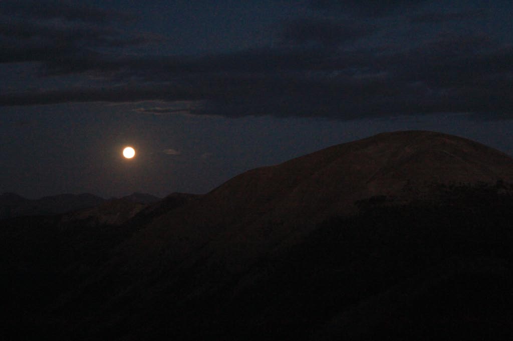
A little ways down the trail, we took shelter from the rain in another of these buildings. This time the storm was not so bad so I got my camera out, and I noticed that there was a small ray of light appearing between the peaks at Independence Pass, coming over from Aspen. Within 5 minutes there were reds, blues, pinks and purples surrounding all of the mountains to the west, and it was a spectacular sight. You could not take a bad picture of the scene, and it has to rank as one of the best sunsets I have ever seen.


The most amazing thing was as the clouds cleared from the taller peaks, they revealed SNOW. Snow was covering every peak from about 12,000 feet up. How incredible!