Day 20
Miles hiked today: 18.3
Miles from Denver: 271.6
Elevation: 11,240 ft
Segments 15, 16
Landmarks: Salida, Fooses Creek, Continental Divide, Continental Divide Trail, Marshall Pass, Mt. Ouray
VIEW MAP
I started out this morning with two other hikers, Paul from DC and Thumbs Up from Colorado Springs. We got a slow start out of town because we made a stop at the First Street Diner and smashed a lot of food. There was a girl named Jamie staying at the hostel who we bribed to drive us up to the trailhead, so she kindly re-arranged and emptied her entire car to fit three cleaned but still slightly smelly hikers, and drove us the 20 or so minutes one way up to the trail.
Segment 15 starts out on a road and ends on a road, but whats in between is really spectacular. We started out by following Fooses Creek from Rt 50 up to the Continental Divide. That was a very long, 8 mile climb. At the top, there is a panoramic view in all directions of dramatic peaks, many of them 14ers. The Continental Divide Trail re-joins with the Colorado Trail here, and will continue with it for over the next 100 miles. We will follow the Divide for quite some time now.
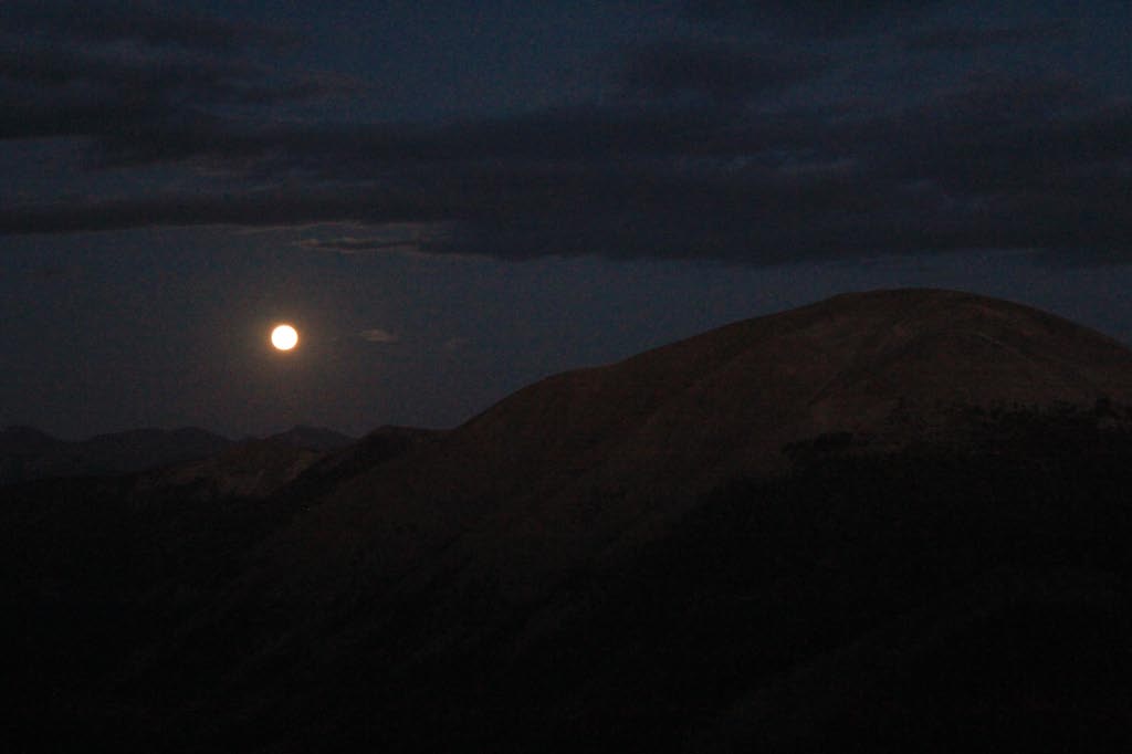
The weather could not have been better. Fat, puffy lazy clouds marched steadily by, as for mile after mile the trail stayed above tree line, affording a different picture each time I looked up. The weather never threatened or wavered, and it was very warm, even by the time I made camp.
Because the trail now follows the Continental Divide for a while, water is very scarce and it has become important to pay close attention to when the next water source is. The length of my hike today was dictated by that, and I was making for a place called Silver Creek which has water a third of a mile off trail. Paul was headed there too, and Thumbs Up was smart and already ate, so he planned to camp wherever there was a good view.


Marshall Pass is a pretty interesting place. It is a route across the mountains that was used by one of the railroads to get to Gunnison, and even though this route was longer, it got there faster because the grades were easier. The guidebook has a story about a Lieutenant William Marshall, who discovered this shortcut because he had a toothache and had to get to Denver in a hurry. As for the trail, a few miles before the pass it is routed onto an old mining road, which today allows use of ATVs and motorcycles. I would find that most of this next segment is like that too, and the quality of the trail drops considerably.
 |
| The only shelter on the entire Colorado Trail |
I stopped about a quarter mile before the water source, knowing I had enough to get through the night, and because I found a campsite on a ridge with a really incredible view to the east. There was a panorama of peaks lit with orange light as I made my dinner and set up camp, and the weather was still as calm as ever. What a great day.